


🚚 Smart Route & Trip Intelligence Service
Turn Coordinates into Actionable Transport Insights
Our Smart Route & Trip Intelligence Service transforms simple latitude and longitude inputs into a complete, data-rich trip overview. Designed for logistics companies, fleet operators, and transport platforms, this service enables smarter planning, accurate costing, and safer decision-making — all from a single API.


🔍 What This Service Does
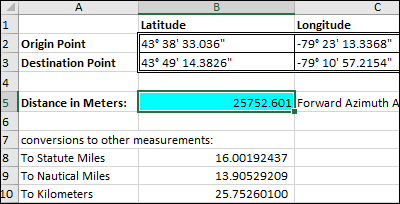
You provide start and end coordinates (lat/long) — we deliver a fully calculated trip profile, including:
- Optimized route mapping
- Road and surface condition analysis
- Distance and estimated travel time
- Terrain and risk indicators
- Actionable data for transport cost calculations
This allows transport businesses to predict outcomes before the trip even starts.
📦 Core Features
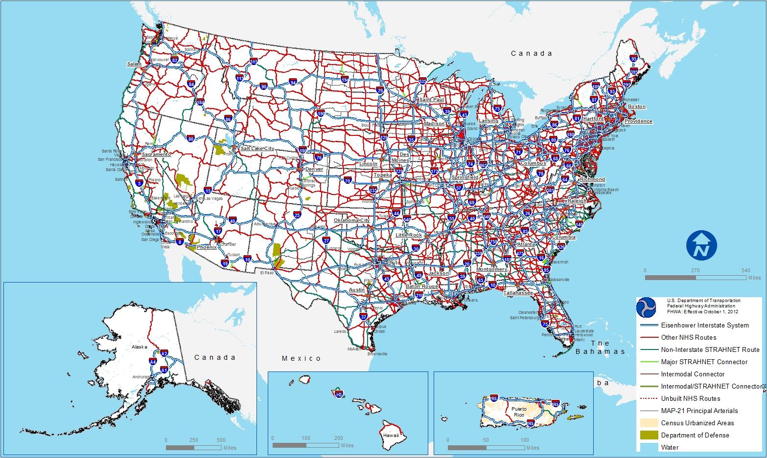
📍 Route Calculation & Optimization
- Converts latitude/longitude into the most efficient driving route
- Supports long-haul, cross-city, and regional trips
- Accounts for road connectivity and transport-friendly paths
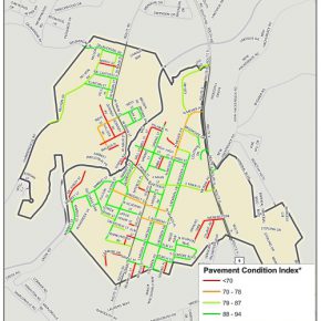
🛣 Road Condition Intelligence
- Identifies road types (highway, city roads, rural routes)
- Highlights poor, average, and good road segments
- Flags challenging sections such as damaged roads or rough terrain
⏱ Distance & Time Estimation
- Total trip distance (KM/Miles)
- Estimated travel time based on road type
- Helps forecast delivery windows and driver shifts
⛰ Terrain & Risk Insights
- Flat vs hilly terrain breakdown
- Useful for fuel estimation and load planning
- Risk indicators for heavy vehicles and sensitive cargo
📊 Transport Cost & Planning Data
Perfect for:
- Fuel consumption calculations
- Driver cost estimation
- Vehicle wear & maintenance forecasting
- Route-based pricing models
🔗 API-First & Developer Friendly
Our service is built for easy integration into existing systems:
- Fleet Management Systems
- Transport ERP platforms
- Logistics dashboards
- Pricing & quotation engines
Input:
Start Latitude, Start Longitude
End Latitude, End Longitude
Output:
Optimized Route
Total Distance
Estimated Travel Time
Road Condition Summary
Terrain & Risk Indicators
🏢 Who Is This For?
- Logistics & Transport Companies
- Trucking & Fleet Operators
- Freight Forwarders
- Delivery & Distribution Networks
- SaaS Platforms needing route intelligence
- Data & Analytics Teams in transport operations
🚀 Why Choose This Service?
- Data-Driven Decisions – Plan trips using real insights, not guesswork
- Cost Efficiency – Optimize fuel, time, and resources
- Scalable API – From a single trip to thousands daily
- Operational Confidence – Know road and terrain challenges upfront
📈 Use Cases
- Automated freight cost calculation
- Route comparison for multiple delivery options
- Truck-specific route validation
- Planning heavy-load or fragile cargo trips
- Transport analytics & reporting
🔒 Reliable, Scalable & Secure
Built with enterprise-grade scalability in mind, our service can handle high-volume requests while maintaining fast response times — perfect for production environments.
📞 Get Started Today
Integrate Smart Route & Trip Intelligence into your platform and turn raw coordinates into powerful transport insights.
Contact Us for API Access
Get updates
Get latest updates
Get latest updates
and deals